Map of Morris Heights, New York City, NY. Streets, roads and houses in Morris Heights
USA / New York / New York CityMorris Heights is a relatively poor neighborhood in the West Bronx, on the bank of East River, right across northern Manhattan. This map shows a scheme of Morris Heights streets, including major sites,
highways and natural objecsts. Move the center of this map by dragging your mouse.
Zoom in or out using the plus/minus panel.
Also check out the satellite map of Morris Heights.
Please share the link with friends and neighbors:
Share on Facebook
Share on WhatsApp
Share on Telegram
Share on Facebook
Share on WhatsApp
Share on Telegram
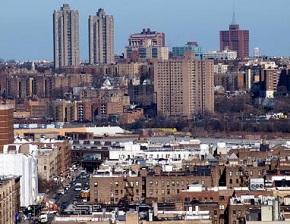
An image of Morris Heights
Check out some more maps of New York City neighborhoods:
This online Morris Heights map of New York City is provided by Bing Maps.
Please add a bookmark (press CTRL+D to add) and share the page with your friends!
© 2024 City maps and famous places