Map of Pelham Gardens, New York City, NY. Streets, roads and houses in Pelham Gardens
USA / New York / New York CityPelham Gardens is a neighborhood in the northeastern part of Bronx with some 10 thousand residents, mostly of Italian and Jewish backgrounds. Most homes in Pelham Gardens are built for 2-3 families. This map shows a scheme of Pelham Gardens streets, including major sites,
highways and natural objecsts. Move the center of this map by dragging your mouse.
Zoom in or out using the plus/minus panel.
Also check out the satellite map of Pelham Gardens.
Please share the link with friends and neighbors:
Share on Facebook
Share on WhatsApp
Share on Telegram
Share on Facebook
Share on WhatsApp
Share on Telegram
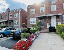
An image of Pelham Gardens
Check out some more maps of New York City neighborhoods:
This online Pelham Gardens map of New York City is provided by Bing Maps.
Please add a bookmark (press CTRL+D to add) and share the page with your friends!
© 2024 City maps and famous places