The exact coordinates of Madera California for your GPS track:
Latitude 36.962067 North, Longitude 120.062035 West.
Please share the link with friends and neighbors:
Share on Facebook
Share on WhatsApp
Share on Telegram
Share on Facebook
Share on WhatsApp
Share on Telegram
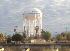
An image of Madera
More city maps of California:
- Map of Bakersfield
Bakersfield is a city located in the southern part of the state of California, in the United State... - Map of Anaheim
Anaheim is a city located in Orange County, California, in the United States. It stands in the Los... - Map of Stockton
Stockton is a city in San Joaquin County, California, located in the Central Valley region of the ... - Map of Irvine
Irvine is a beautiful city located in Orange County with more than 210 thousand inhabitants.... - Map of Los Angeles
Los Angeles is the second-largest city of the US and one of the Global cities. The city is situate... - Map of Sacramento
Sacramento is the official Capital City of California state. It's population is close to half a mi... - Map of Santa Clarita
Santa Clarita is a large northwestern suburb of Los Angeles with over 224 thousand inhabitants.... - Map of Hayward
Hayward, California is a city in San Francisco Bay area. Its population is over 159 thousand.... - Map of Sunnyvale
Sunnyvale, California is the second largest city in Santa Clara county. Sunnyvale is one of the ma... - Map of Orange
Orange, California is a city located between Santa Ana and Anaheim. The population of Orange is ap... - Map of Santa Clara
The City of Santa Clara, California is located in the center of the famous Silicon Valley, just 2 ... - Map of Vallejo
Vallejo, California (incorporated 1868) is a city in the San Francisco Bay Area with 120 thousand ... - Map of Downey
Downey, California is a large southeastern suburb of Los Angeles and home for Apollo space program... - Map of West Covina
West Covina is a city located 20 miles east of Los Angeles, in San Gabriel Valley. The population ... - Map of San Mateo
San Mateo (incorporated in 1894) is a city in San Francisco bay area, in the central part of the S... - Map of South Gate
South Gate, California, incorporated 1923, is a southeastern suburb of Los Angeles with 94 thousan... - Map of Hesperia
Hesperia, California, is a city located in Mojave Desert, north to San Bernardino. The population ...
Full list of California maps
This online map of Madera, California is provided by Bing Maps. Please add a bookmark and share the page with your friends!