The exact coordinates of National City California for your GPS track:
Latitude 32.676937 North, Longitude 117.097534 West.
Please share the link with friends and neighbors:
Share on Facebook
Share on WhatsApp
Share on Telegram
Share on Facebook
Share on WhatsApp
Share on Telegram
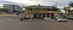
An image of National City
More city maps of California:
- Map of Oakland
Oakland is a city located in the state of California, in the United States. It stands in the San F... - Map of Santa Ana
Santa Ana is a city in Orange County, California, located approximately 35 miles south of Los Ange... - Map of Chula Vista
Chula Vista is a city near San Diego in California. The name Chula Vista means "Beautiful View" in... - Map of Fremont
Fremont is a city in Alameda County, California. It stands near San Jose and has a population of 2... - Map of Fontana
Fontana is a city in San Bernardino county, California. It's population is close to 210 thousand p... - Map of San Francisco
San Francisco is one of the biggest cities in California. It is a major cultural and business cent... - Map of Glendale
Glendale, California is a city in Los Angeles area with almost 200 thousand inhabitants.... - Map of Oceanside
Oceanside is a midsize coastal city in southern California with 172 thousand inhabitants. During t... - Map of Palmdale
Palmdale, California is a city located to the north of Los Angeles. The population is about 165 th... - Map of Thousand Oaks
Thousand Oaks, California is a city located to the northwest of downtown Los Angeles. The populati... - Map of Simi Valley
Simi Valley, California is a large northwestern suburb of Los Angeles with 124 thousand inhabitant... - Map of Victorville
Victorville (incorporated 1962) is a city in the Victor Valley, southern California. The populatio... - Map of El Monte
El Monte, California is a city located in the San Gabriel Valley, not far away from downtown Los A... - Map of Costa Mesa
Costa Mesa (incorporated in 1953) is a city in California, located in Map of Inglewood
Inglewood, California is a southwestern suburb of Los Angeles with 111 thousand inhabitants. The c... - Map of Temecula
Temecula is a city in Riverside County, southern Cal... - Map of Murrieta
Murrieta is a young and fast growing city in California with 108 thousand inhabitants. Murrieta is...
Full list of California maps
This online map of National City, California is provided by Bing Maps. Please add a bookmark and share the page with your friends!