The exact coordinates of Broomfield Colorado for your GPS track:
Latitude 39.923458 North, Longitude 105.067139 West.
Please share the link with friends and neighbors:
Share on Facebook
Share on WhatsApp
Share on Telegram
Share on Facebook
Share on WhatsApp
Share on Telegram
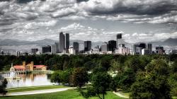
An image of Broomfield
More city maps of Colorado:
- Map of Fort Collins
Fort Collins is the fourth largest city in Colorado with a population of about 168 thousand people... - Map of Thornton
Thornton, Colorado is a big northern suburb of Denver, with over 118 thousand inhabitants. The cit... - Map of Boulder
Update: at least 10 dead, including police off... - Map of Greeley
Greeley, Colorado (incorporated 1885) is a city located in Weld County, about 50 miles north to De... - Map of Longmont
Longmont, Colorado is a city founded in 1871 and now sharing the 13-th place in Colorado's most po... - Map of Commerce City
Commerce City is a large northeastern suburb of Denver with more than 60 thousand residents. It wa... - Map of Brighton
Brighton, Colorado is the county seat of Adams County. The city's population exceeds 40 thousand r... - Map of Northglenn
Northglenn, Colorado is a master planned community found in Adams County, about 12 miles north of ... - Map of Wheat Ridge
Wheat Ridge, Colorado is a suburban municipality of Denver, located in Jefferson County. Wheat Rid... - Map of Fountain
Fountain, Colorado is a home rule municipality located 15 miles southeast of Colorado Springs, in ... - Map of Clifton
Clifton, Colorado is a CDP situated near Grand Junction, in Mesa County. Today Clifton is populate... - Map of Sherrelwood
Sherrelwood, Colorado is an unincorporated community and census-designated place located in Adams ... - Map of Fort Carson
Fort Carson is a United States Army installation located in El Paso County, Colorado, near the cit... - Map of Black Forest
Black Forest, Colorado is a rural community located in El Paso County. It is an unincorporated are... - Map of Fruita
Fruita, Colorado is a shining city located in Mesa County. It is situated in western Colorado, nea... - Map of Castle Pines
Castle Pines, Colorado is a city located in Douglas County. It is a suburban community situated in... - Map of Gunbarrel
Gunbarrel, Colorado is an unincorporated community located in Boulder County. It is situated north...
Full list of Colorado maps
This online map of Broomfield, Colorado is provided by Bing Maps. Please add a bookmark and share the page with your friends!