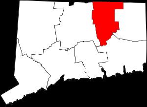
Tolland County is located in the northern section of Connecticut. This wealthy county was founded in 1785. The county is populated by 150 thousand people. The county seat of Tolland County is Rockville. The total area of the county is estimated at 410 square miles. This map shows the borders of Tolland County as well as neighboring counties,
including major highways and natural objecsts as of 2024.
Zoom in or out of the map using the plus/minus panel. Move the center of this map by dragging it.
Also check out the satellite map of Tolland County.
Please share the map of Tolland County with your friends:
The borders of Tolland County over the map of Connecticut
Explore some more counties of Connecticut:
This online map of Tolland County, Connecticut is provided by Bing Maps.
Please add a bookmark and share the page with your friends!