The exact coordinates of Ottumwa Iowa for your GPS track:
Latitude 41.015495 North, Longitude 92.407524 West.
Please share the link with friends and neighbors:
Share on Facebook
Share on WhatsApp
Share on Telegram
Share on Facebook
Share on WhatsApp
Share on Telegram
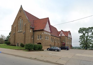
An image of Ottumwa

More city maps of Iowa:
- Map of Cedar Rapids
Cedar Rapids AKA "City of Five Seasons" is the second largest city in the state of Iowa with popul... - Map of Dubuque
Dubuque, founded in 1833, is a city on the eastern edge of Iowa with 57 thousand residents. It sta... - Map of Cedar Falls
Cedar Falls, Iowa is a stylish city found near Waterloo, in Hawk County. The population of Cedar F... - Map of Muscatine
Muscatine, Iowa is a city situated along the Mississippi River and the county seat of Muscatine Co... - Map of Norwalk
Norwalk, Iowa is a charming city found in Warren County, and is a suburb of Des Moines. Norwalk is... - Map of Le Mars
Le Mars is a city located in northwestern Iowa, and is the county seat of Plymouth County. Le Mars... - Map of Pleasant Hill
Pleasant Hill, Iowa is an adorable city located in Polk County, a suburb of Des Moines. Pleasant H... - Map of Mount Pleasant
Mount Pleasant is a city located in Henry County, in southeastern Iowa. The city has a historic do... - Map of Webster City
Webster City is a city located in Hamilton County, in north-central Iowa. Historically, Webster Ci... - Map of Washington
Washington, Iowa is the county seat of Washington County, southeastern Iowa. Washington has a rich... - Map of Eldridge
Eldridge is a wonderful city situated in Scott County in eastern Iowa, near the city of Davenport.... - Map of Polk City
Polk City is a city located in Polk County, in central Iowa, about 20 miles north of the city of D... - Map of Osceola
Osceola is a city in Clarke County, located in southern Iowa, about 50 miles south of Des Moines. ... - Map of Sheldon
Sheldon is a city in O'Brien County, in the northwestern part of Iowa. The local economy of Sheldo... - Map of Sergeant Bluff
Sergeant Bluff is a city in Woodbury County, Iowa. It is located in western Iowa, near the borders...
Full list of Iowa maps
This online map of Ottumwa, Iowa is provided by Bing Maps. Please add a bookmark and share the page with your friends!
