Knox County is a small coastal county located in the southern portion of Maine. The county seat of Knox County is Rockland. The overall area of the county is about 1,142 square miles. Set up in 1860 from parts of Lincoln County and Waldo County, today Knox County counts over 41 thousand inhabitants. The county is named after Henry Knox (1750-1806), the first United States Secretary of War (1789 - 1794), who lived in Thomaston, Maine. This map shows the borders of Knox County as well as neighboring counties,
including major highways and natural objecsts as of 2024.
Zoom in or out of the map using the plus/minus panel. Move the center of this map by dragging it.
Also check out the satellite map of Knox County.
Please share the map of Knox County with your friends:
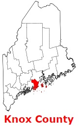
The borders of Knox County over the map of Maine
Explore some more counties of Maine:
This online map of Knox County, Maine is provided by Bing Maps.
Please add a bookmark and share the page with your friends!