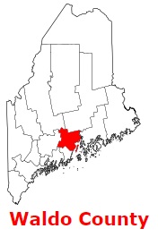
Waldo County is a coastal county situated in the southern section of Maine. The population of Waldo County exceeds 40 thousand people. The county, formed back in 1827 from parts of Hancock County, Kennebec County and Lincoln County, spans a total area of 853 square miles. The county seat of Waldo County is Belfast. The county is named after Samuel Waldo, Maine landowner and a colonial soldier in the 1745 siege of Louisbourg. This map shows the borders of Waldo County as well as neighboring counties,
including major highways and natural objecsts as of 2024.
Zoom in or out of the map using the plus/minus panel. Move the center of this map by dragging it.
Also check out the satellite map of Waldo County.
Please share the map of Waldo County with your friends:
The borders of Waldo County over the map of Maine
Explore some more counties of Maine:
This online map of Waldo County, Maine is provided by Bing Maps.
Please add a bookmark and share the page with your friends!