The exact coordinates of Chesterfield Michigan for your GPS track:
Latitude 42.665249 North, Longitude 82.841087 West.
Please share the link with friends and neighbors:
Share on Facebook
Share on WhatsApp
Share on Telegram
Share on Facebook
Share on WhatsApp
Share on Telegram
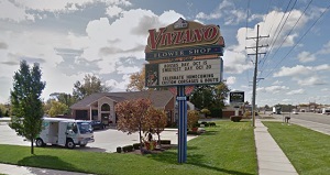
An image of Chesterfield
More city maps of Michigan:
- Map of Warren
Warren, Michigan is a large northern suburb of Detroit. It is the biggest city in Macomb County wi... - Map of Clinton
Clinton Township is a large northern suburb of Detroit with 100 thousand residents. It is the larg... - Map of Macomb
Macomb Township, Michigan is a northern suburb of Detroit with 89 thousand residents. The township... - Map of Kalamazoo
Kalamazoo, incorporated 1884, is a city in southern Michigan with 76 thousand inhabitants. The cit... - Map of Waterford
Waterford, Michigan is a beautiful charter township situated in Oakland County, on the northern ed... - Map of Pontiac
Pontiac, Michigan is a positive city and the county seat of Oakland County. It stands only 30 mile... - Map of Battle Creek
Battle Creek is a cool city located in Calhoun County of Michigan. Battle Creek is home to 52 thou... - Map of Commerce
The Charter Township of Commerce, Michigan is found 35 miles northwest to Detroit, in Oakland Coun... - Map of Holland Charter Township
Holland Charter Township is situated in Ottawa County of Michigan. Today Holland Charter Township ... - Map of Bay City
Bay City, Michigan is the county seat of Bay County. The population of Bay City exceeds 32 thousan... - Map of Van Buren
Van Buren, Michigan is a charter township located 28 miles southwest of Detroit, in Wayne County.... - Map of Oak Park
Oak Park, Michigan is a wonderful city situated 15 miles northwest of Detroit, in Oakland County. ... - Map of Hamtramck
Hamtramck, Michigan is a wonderful suburban city of Detroit, situated in Wayne County. Incorporate... - Map of Allendale
Allendale, Michigan is a charter township located in Ottawa County, 15 miles west of Grand Rapids.... - Map of Auburn Hills
Auburn Hills, Michigan is an attractive city located in Oakland County, about 33 miles north of De... - Map of Lyon Township
Lyon, Michigan is a beautiful charter township located in Oakland County. Established in 1834, Lyo... - Map of Hamburg
Hamburg Township, Michigan is found in Livingston County, 54 miles west of Detroit. The population...
Full list of Michigan maps
This online map of Chesterfield, Michigan is provided by Bing Maps. Please add a bookmark and share the page with your friends!