The exact coordinates of Livonia Michigan for your GPS track:
Latitude 42.397221 North, Longitude 83.373611 West.
Please share the link with friends and neighbors:
Share on Facebook
Share on WhatsApp
Share on Telegram
Share on Facebook
Share on WhatsApp
Share on Telegram
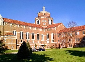
An image of Livonia
More city maps of Michigan:
- Map of Detroit
Detroit is the biggest city in Michigan. It's a big industrial center known for its vehicle indust... - Map of Farmington Hills
Farmington Hills, Michigan is a northern suburb of Detroit with 83 thousand residents. The city wa... - Map of Taylor
Taylor, Michigan is a cool city located in Wayne County, on the southern edge of Detroit metro are... - Map of Ypsilanti
Ypsilanti, Michigan is a beautiful city situated in Washtenw County. Ypsilanti is home to 20 thous... - Map of Roseville
Roseville, Michigan is a nice suburb of Detroit situated in Macomb County. Roseville is home to 47... - Map of Bloomfield Township
Bloomfield, Michigan is a charter township located about 25 miles northwest to Detroit, in Oakland... - Map of Grand Blanc
Grand Blanc, Michigan is a nice township located near Flint, in Genesee County. Founded in 1833, t... - Map of Muskegon
Muskegon, Michigan is a lakeside city and the county seat of Muskegon County. Today Muskegon is po... - Map of Brownstown
Brownstown, Michigan is a charter township situated about 22 miles southwest of Detroit, in Wayne ... - Map of Jackson
Jackson, Michigan is a stylish city and county seat of Jackson County. The population of Jackson e... - Map of Southgate
Southgate, Michigan is a beautiful city located in Wayne County, 14 miles southwest of downtown De... - Map of Madison Heights
Madison Heights, Michigan is a beautiful city located 12 miles north of downtown Detroit, in Oakla... - Map of Byron Township
Byron Township, Michigan is found in Kent County, about 13 miles south of Grand Rapids. The popula... - Map of Walker
Walker, Michigan is a beautiful city located in Kent County, to the northwest of Grand Rapids. Wal... - Map of Harrison Township
Harrison Township, Michigan is a stylish city found in Macomb County. The population of Harrison T... - Map of Birmingham
Birmingham, Michigan is a wonderful city situated in Oakland Countyб 20 miles northwest of Detroi... - Map of Davison Township
Davison Township, Michigan is located 60 miles northwest of Detroit, in Lapeer County. Davison Tow...
Full list of Michigan maps
This online map of Livonia, Michigan is provided by Bing Maps. Please add a bookmark and share the page with your friends!