The exact coordinates of Saginaw Michigan for your GPS track:
Latitude 43.43327 North, Longitude 83.938988 West.
Please share the link with friends and neighbors:
Share on Facebook
Share on WhatsApp
Share on Telegram
Share on Facebook
Share on WhatsApp
Share on Telegram
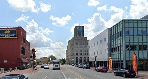
An image of Saginaw
More city maps of Michigan:
- Map of Lansing
Lansing is the capital city of Michigan with population of around 114 thousand people. It was foun... - Map of Canton
Canton Township is located on the western outskirts of Detroit. Its population exceeds 95 thousand... - Map of Shelby
Shelby Charter Township is a CDP in Macomb County. This northern suburb of Detroit is growing fast... - Map of Rochester Hills
Rochester Hills, Michigan is a remarkable city located in Oakland County, 28 miles north to Detroi... - Map of Dearborn Heights
Dearborn Heights, Michigan is a nice suburban city of Detroit situated in Wayne County. Dearborn H... - Map of Kentwood
Kentwood, Michigan is a wonderful suburban city of Grand Rapids situated in Kent County. Kentwood ... - Map of East Lansing
East Lansing, Michigan is a remarkable suburban city of Lansing located mostly in Ingham County. T... - Map of Georgetown Township
Georgetown Township, Michigan is a remarkable township located in Ottawa County. Georgetown Townsh... - Map of Lincoln Park
Lincoln Park, Michigan is a suburban city of Detroit, found in Wayne County. The population of Lin... - Map of Independence Township
Independence, Michigan is a nice township located on the northern outskirts of Detroit, in Oakland... - Map of Delta
Delta, Michigan is a charter township located in Eaton County. Delta is home to 33 thousand reside... - Map of White Lake
White Lake, Michigan is a charter township located in Oakland County. White Lake is home to 31 tho... - Map of Burton
Burton, Michigan is a stylish city located about 71 miles northwest of Detroit, in Genesee County.... - Map of Allen Park
Allen Park, Michigan (incorporated in 1957) is an industrial city found in Wayne County, 12 miles ... - Map of Garden City
Garden City, Michigan is a wonderful city situated in Wayne County, 13 miles west of downtown Detr... - Map of Romulus
Romulus, Michigan is a stylish city found in Wayne County, about 23 miles southwest of Detroit. Th... - Map of Oshtemo
Oshtemo, Michigan is a wonderful charter township situated in Kalamazoo County. Today Oshtemo is p...
Full list of Michigan maps
This online map of Saginaw, Michigan is provided by Bing Maps. Please add a bookmark and share the page with your friends!