The exact coordinates of St. Michael Minnesota for your GPS track:
Latitude 45.210678 North, Longitude 93.661469 West.
Please share the link with friends and neighbors:
Share on Facebook
Share on WhatsApp
Share on Telegram
Share on Facebook
Share on WhatsApp
Share on Telegram
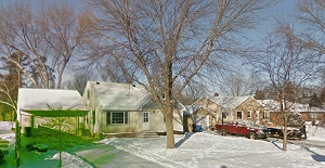
An image of St. Michael
More city maps of Minnesota:
- Map of Rochester
Rochester (founded 1854) is the third largest city in Minnesota and a county seat of Olmsted Count... - Map of Brooklyn Center
Brooklyn Center, incorporated 1966, is a city in Hennepin County, Minnesota. It is actually just a... - Map of St. Cloud
St. Cloud, Minnesota, known as "The Granite City" is located in the central part of the state, som... - Map of Eden Prairie
Eden Prairie, Minnesota is a cool suburban city situated in Hennepin County. Today Eden Prairie is... - Map of Mankato
Mankato, Minnesota is a stylish city found about 80 miles southwest to Minneapolis. The population... - Map of Richfield
Richfield, Minnesota (incorporated in 1908) is a suburban city of Minneapolis, standing in Hennepi... - Map of Savage
Savage, Minnesota is a nice suburban city of Minneapolis, located in Scott County. Incorporated ba... - Map of Oakdale
Oakdale, Minnesota is an attractive city located near Saint Paul in Washington County. Organized i... - Map of Elk River
Elk River, Minnesota is an attractive city located in Sherburne County, about 30 miles northwest o... - Map of Farmington
Farmington, Minnesota is a wonderful city standing 30 miles south of Minneapolis, in Dakota County... - Map of Hastings
Hastings, Minnesota is a dynamic city and the seat of Dakota County. The population of Hastings ex... - Map of Willmar
Willmar, Minnesota is a dynamic city and the county seat of Kandiyohi County. The population of Wi... - Map of Red Wing
Red Wing, Minnesota is a shining city located in Goodhue County. It stands in the southeastern par... - Map of Bemidji
Bemidji, Minnesota is a city located in Beltrami County. It stands in the northern part of the sta... - Map of Brainerd
Brainerd, Minnesota is a wonderful city found in Crow Wing County. It stands in the central part o... - Map of Worthington
Worthington is a city located in Nobles County, Minnesota. It stands in the southwestern part of t... - Map of Waconia
Waconia, Minnesota is a charming city situated in Carver County. It stands in the central part of ...
Full list of Minnesota maps
This online map of St. Michael, Minnesota is provided by Bing Maps. Please add a bookmark and share the page with your friends!