Cumberland County on the map of North Carolina 2025. Cities, roads, borders and directions in Cumberland County of North Carolina.
USA / North Carolina / Cumberland CountyCumberland County is placed in the central region of North Carolina. The total population of Cumberland County exceeds 336 thousand people. The county, formed back in 1754 as a part of Bladen County, covers an area of 658 square miles. The county seat of Cumberland County is Fayetteville. The county is named after Prince William, Duke of Cumberland (1721-1765), a military leader and son of George II. This map shows the borders of Cumberland County as well as neighboring counties, including major highways and natural objecsts as of 2025. Zoom in or out of the map using the plus/minus panel. Move the center of this map by dragging it. Also check out the satellite map of Cumberland County.
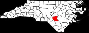
The borders of Cumberland County over the map of North Carolina
Explore some more counties of North Carolina:
- Yancey County
- Yadkin County
- Wilson County
- Wilkes County
- Wayne County
- Watauga County
- Washington County
- Warren County
- Vance County
- Union County
- Tyrrell County
- Transylvania County
- Swain County
- Surry County
- Stokes County
- Stanly County
- Scotland County
- Sampson County
- Rutherford County
- Rowan County
Full list of North Carolina maps
This online map of Cumberland County, North Carolina is provided by Bing Maps. Please add a bookmark and share the page with your friends!
© 2025 City maps and famous places