The exact coordinates of Gastonia North Carolina for your GPS track:
Latitude 35.262821 North, Longitude 81.184158 West.
Please share the link with friends and neighbors:
Share on Facebook
Share on WhatsApp
Share on Telegram
Share on Facebook
Share on WhatsApp
Share on Telegram
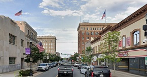
An image of Gastonia
More city maps of North Carolina:
- Map of Raleigh
Raleigh is the capital city of North Carolina, and the second largest city in the state, with a po... - Map of Winston-Salem
Winston-Salem is a city in the U.S. state of North Carolina, located in Forsyth County. The city h... - Map of High Point
High Point is a city in the central part of North Carolina, not far away from Greensboro. The popu... - Map of Chapel Hill
Chapel Hill is a famous town in North Carolina with 57 thousand residents. It is known for hosting... - Map of Apex
Apex, North Carolina is a remarkable suburban town located near Raleigh, in Wake County. Apex is h... - Map of Mooresville
Mooresville, North Carolina is a nice town situated about 28 miles north to Charlotte, in Iredell ... - Map of Indian Trail
Indian Trail, North Carolina is a southeastern suburban town of Charlotte, located in Union County... - Map of Fuquay-Varina
Fuquay-Varina, North Carolina is a nice town located 18 miles southwest of Raleigh, in Wake County... - Map of Cornelius
Cornelius, North Carolina is a charming town found in Mecklenburg County, on the northern edge of ... - Map of Statesville
Statesville, North Carolina is a dynamic city and the seat of Iredell County. It is situated in th... - Map of Mint Hill
Mint Hill, North Carolina is a shining town located in Mecklenburg County. It is situated in the C... - Map of Carrboro
Carrboro, North Carolina is a hilarious town situated in Orange County. It is part of the Chapel H... - Map of Kinston
Kinston, North Carolina is a shining city located in Lenoir County, approximately 75 miles southea... - Map of Harrisburg
Harrisburg, North Carolina is a lovely town situated in Cabarrus County. It stands in the southern... - Map of Morganton
Morganton, North Carolina is a wonderful city found in Burke County. Morganton sits in the western... - Map of Albemarle
Albemarle, North Carolina is a pleasant city located in Stanly County. It stands in the central pa... - Map of Laurinburg
Laurinburg, North Carolina is a charming city found in Scotland County. It is situated in the sout...
Full list of North Carolina maps
This online map of Gastonia, North Carolina is provided by Bing Maps. Please add a bookmark and share the page with your friends!