The exact coordinates of Ewing Township New Jersey for your GPS track:
Latitude 40.259098 North, Longitude 74.790344 West.
Please share the link with friends and neighbors:
Share on Facebook
Share on WhatsApp
Share on Telegram
Share on Facebook
Share on WhatsApp
Share on Telegram
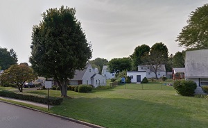
An image of Ewing Township
More city maps of New Jersey:
- Map of Paterson
Paterson, New Jersey is a city located on the northwestern outskirts of New York City. It has a po... - Map of Toms River
Toms River is a mid-sized township in Ocean County of New Jersey. It has a population of over 91 t... - Map of Union City
Union City, New Jersey is an excellent city located in Hudson County on the opposite bank to Manha... - Map of Jackson
Jackson, New Jersey is a prominent township situated in Ocean County. The total population of Jack... - Map of Perth Amboy
Perth Amboy, New Jersey is a coastal city located about 30 miles south to NYC, in Middlesex County... - Map of West New York
West New York, New Jersey is a beautiful town situated in Hudson County, on the western bank of th... - Map of Union Township
Union Township, New Jersey is a nice town located in Union County. Incorporated on November 23, 18... - Map of West Orange
West Orange, New Jersey is a suburban township located in Essex County. The township covers an are... - Map of Hackensack
Hackensack, New Jersey is a charming city located in Bergen County. Hackensack is located in north... - Map of Berkeley Township
Berkeley, New Jersey is a dynamic township located in Ocean County. Berkeley was originally settle... - Map of Teaneck
Teaneck, New Jersey is an adorable township located in Bergen County. Teaneck was originally settl... - Map of Atlantic City
Atlantic City is a lovely resort city located on the Atlantic coast of New Jersey. Atlantic City i... - Map of Garfield
Garfield is a city in Bergen County, New Jersey. It is located approximately 10 miles west of New ... - Map of Westfield
Westfield, New Jersey is an adorable town located in Union County, 20 miles southwest of New York ... - Map of West Windsor
West Windsor, New Jersey is a charming township located in Mercer County, about 10 miles east of T... - Map of Bergenfield
Bergenfield is a borough located in Bergen County, New Jersey. It stands approximately 14 miles no... - Map of Pemberton Township
Pemberton Township, New Jersey is a lovely community located in Burlington County. Pemberton Towns...
Full list of New Jersey maps
This online map of Ewing Township, New Jersey is provided by Bing Maps. Please add a bookmark and share the page with your friends!