The exact coordinates of Lodi New Jersey for your GPS track:
Latitude 40.882385 North, Longitude 74.081963 West.
Share on Facebook
Share on WhatsApp
Share on Telegram
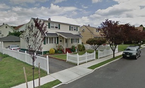
An image of Lodi

More city maps of New Jersey:
- Map of Elizabeth
Elizabeth, New Jersey is the 4-th largest city of this state with a population of over 137 thousan... - Map of Trenton
Trenton (population: 85k) is the capital city of New Jersey, located just between NYC and Philadel... - Map of Brick
Brick Township is a nice coastal settlement in Ocean County of New Jersey, 60 miles east to Philad... - Map of East Orange
East Orange, New Jersey is a remarkable city located in Essex County, about 17 miles west to Manha... - Map of Vineland
Vineland, New Jersey is a wonderful city situated in Cumberland County, about 45 miles south to Ph... - Map of Hoboken
Hoboken, New Jersey is a remarkable city located in Hudson County, on the western bank of Hudson R... - Map of Plainfield
Plainfield, New Jersey is a wonderful city situated about 30 miles southwest to New York City, in ... - Map of Gloucester Township
Gloucester Township, New Jersey is a nice township located in the suburban area of Philadelphia, i... - Map of Monroe Township, Middlesex County
Monroe Township is located in Middlesex County, New Jersey. It was officially incorporated as a to... - Map of Sayreville
Sayreville, New Jersey is a borough located in Middlesex County. Sayreville was originally incorpo... - Map of Linden
Linden, New Jersey is a wonderful city located in Union County. Linden was originally settled in t... - Map of Manalapan Township
Manalapan, New Jersey is a pleasant township located in Monmouth County. Manalapan was originally ... - Map of Belleville
Belleville, New Jersey is a charming township located in Essex County. Belleville was originally s... - Map of Pennsauken Township
Pennsauken is a township located in Camden County, New Jersey. Pennsauken Township covers an area ... - Map of Deptford
Deptford, New Jersey is a wonderful township in Gloucester County. It is located approximately 10 ... - Map of Voorhees Township
Voorhees is a township located in Camden County, New Jersey. It stands approximately 16 miles sout... - Map of Englewood
Englewood is a city in Bergen County, New Jersey. It is located approximately 10 miles northwest o...
Full list of New Jersey maps
This online map of Lodi, New Jersey is provided by Bing Maps. Please add a bookmark and share the page with your friends!
