The exact coordinates of Henderson Nevada for your GPS track:
Latitude 36.031715 North, Longitude 114.981987 West.
Please share the link with friends and neighbors:
Share on Facebook
Share on WhatsApp
Share on Telegram
Share on Facebook
Share on WhatsApp
Share on Telegram
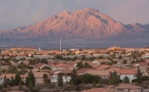
An image of Henderson
More city maps of Nevada:
- Map of Reno
Reno is the county seat of Washoe County, Nevada, and is located in the western part of the state.... - Map of Sunrise Manor
Sunrise Manor, founded 1957, is an unincorporated town on the eastern edge of Las Vegas metro area... - Map of Winchester
Winchester, Nevada is a wonderful town situated on the southern edge of Las Vegas, in Clark County... - Map of Summerlin South
Summerlin South, Nevada is a CDP located near Spring Valley in Clark County. Summerlin South is ho... - Map of Spring Creek
Spring Creek is a census-designated place located in Elko County, Nevada. It stands in northeaster...
Full list of Nevada maps
This online map of Henderson, Nevada is provided by Bing Maps. Please add a bookmark and share the page with your friends!