The exact coordinates of Taylorsville Utah for your GPS track:
Latitude 40.65517 North, Longitude 111.938957 West.
Please share the link with friends and neighbors:
Share on Facebook
Share on WhatsApp
Share on Telegram
Share on Facebook
Share on WhatsApp
Share on Telegram
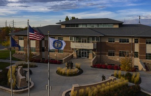
An image of Taylorsville
More city maps of Utah:
- Map of West Valley City
West Valley City is a large southwestern suburb of Salt Lake City with more than 120 thousand inha... - Map of Ogden
Ogden is a city in Utah, located some 40 miles north of Salt Lake City. The population of Ogden st... - Map of Bountiful
Bountiful, Utah (incorporated 1892) is a wonderful city located 10 miles north to Salt Lake City, ... - Map of Pleasant Grove
Pleasant Grove, Utah is a nice city situated near Provo in Utah County. Incorporated on January 18... - Map of Midvale
Midvale, Utah is a beautiful city found in Salt Lake County, about 11 miles south of Salt Lake Cit... - Map of Syracuse
Syracuse, Utah (incorporated in 1950) is a stylish city standing about 30 miles north of Salt Lake... - Map of Washington
Washington, Utah is an adorable city located near St. George in Washington County. Settled back in... - Map of Magna
Magna, Utah is a CDP in Salt Lake County. It is part of the Salt Lake City Metro Area. Today Magna... - Map of Payson
Payson, Utah is a dynamic city found in the central part of Utah, in the heart of the Wasatch Moun... - Map of West Haven
West Haven, Utah is a lovely city located in Weber County. It stands in the northern part of the s... - Map of Smithfield
Smithfield, Utah is a shining city situated in Cache County. It stands in the northern part of the... - Map of Mapleton
Mapleton, Utah is a city located in Utah County. It stands in the central part of the state, south... - Map of Vernal
Vernal, Utah is a wonderful city that serves as the seat of Uintah County. It is situated in the n...
Full list of Utah maps
This online map of Taylorsville, Utah is provided by Bing Maps. Please add a bookmark and share the page with your friends!