The exact coordinates of Colonial Heights Virginia for your GPS track:
Latitude 37.265781 North, Longitude 77.392174 West.
Please share the link with friends and neighbors:
Share on Facebook
Share on WhatsApp
Share on Telegram
Share on Facebook
Share on WhatsApp
Share on Telegram
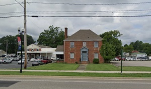
An image of Colonial Heights
More city maps of Virginia:
- Map of Virginia Beach
Virginia Beach is an independent city located in the Hampton Roads region of Virginia in the Unite... - Map of Alexandria
Alexandria is a mid-sized city in Virginia, south to Washington, DC, with some 140 thousand inhabi... - Map of Lynchburg
Lynchburg (incorporated in 1852) is an independent city in central Virginia with 79 thousand resid... - Map of Centreville
Centreville, Virginia is a western suburb of Washington DC with 74 thousand inhabitants. It is a C... - Map of Lake Ridge
Lake Ridge, Virginia is a CDP located in Prince William County, just about 25 miles south-west to ... - Map of Annandale
Annandale, Virginia is a CDP with 42 thousand residents, located about 17 miles southwest to Washi... - Map of Mechanicsville
Mechanicsville, Virginia is a suburban CDP of Richmond situated in Hanover County. Today Mechanics... - Map of Petersburg
Petersburg, Virginia is a nice city located in Dinwiddie County. Petersburg is home to 33 thousand... - Map of Fair Oaks
Fair Oaks, Virginia is a CDP located 22 miles west of Washington, DC, in Fairfax County. Fair Oaks... - Map of Short Pump
Short Pump, Virginia is a wonderful CDP situated near Richmond, in Henrico County. Today Short Pum... - Map of Herndon
Herndon, Virginia is a dynamic town found in Fairfax County. The population of Herndon exceeds 24 ... - Map of Christiansburg
Christiansburg, Virginia is a lovely town located in Montgomery County. Incorporated on November 1... - Map of Woodlawn
Woodlawn, Virginia is a CDP located in Fairfax County, about 19 miles south of Washington DC. Toda... - Map of Culpeper
The town of Culpeper, Virginia is the county seat of Culpeper County. Founded back in 1759, today ... - Map of Buckhall
Buckhall, Virginia is a charming unincorporated community located in Prince William County. It sta... - Map of Gainesville
Gainesville, Virginia is a lovely suburban community located in Prince William County, in the nort... - Map of Wolf Trap
Wolf Trap, Virginia is a CDP located in Fairfax County, in the northern part of the state. It is s...
Full list of Virginia maps
This online map of Colonial Heights, Virginia is provided by Bing Maps. Please add a bookmark and share the page with your friends!