The exact coordinates of Franconia Virginia for your GPS track:
Latitude 38.780579 North, Longitude 77.145805 West.
Please share the link with friends and neighbors:
Share on Facebook
Share on WhatsApp
Share on Telegram
Share on Facebook
Share on WhatsApp
Share on Telegram
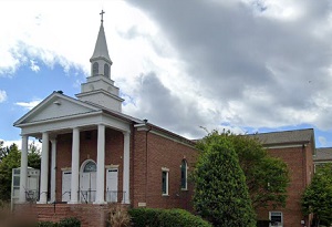
An image of Franconia
More city maps of Virginia:
- Map of Norfolk
Norfolk is a city located in the coastal region of the state of Virginia, in the United States. It... - Map of Newport News
Newport News is the fifth largest city in Virginia. Founded in 1866, today it is home to 184 thous... - Map of Arlington
Arlington, Virginia is a city located on the western bank of Potomac river, adjacent to Washington... - Map of Suffolk
Suffolk, Virginia (founded in 1742) is an independent city located 40 miles west of Virginia Beach... - Map of Harrisonburg
Harrisonburg, Virginia (incorporated 1916) is an independent city with 53 thousand inhabitants. It... - Map of Tuckahoe
Tuckahoe, Virginia is a large western suburb of Richmond with 48 thousand residents. It has a stat... - Map of Woodbridge
Woodbridge, Virginia is a census-designated place with 42 thousand inhabitants. It is situated in ... - Map of Linton Hall
Linton Hall, Virginia is a fascinating CDP found in Prince William County. The population of Linto... - Map of Sterling
Sterling, Virginia is a charming CDP in Loudoun County. The population of Sterling exceeds 31 thou... - Map of Winchester
Winchester, Virginia is an independent city and the county seat of Frederick County. The populatio... - Map of Cave Spring
Cave Spring, Virginia is a shining CDP located in Roanoke County. Today Cave Spring is home to 25 ... - Map of Hopewell
Hopewell, Virginia (incorporated 1916) is a dynamic independent city found inside Prince George Co... - Map of Leesylvania
Leesylvania, Virginia is a pleasant CDP found in Prince William County. The population of Leesylva... - Map of McNair
McNair, Virginia is a charming CDP located near Washington Dulles International Airport, in Fairfa... - Map of Franklin Farm
Franklin Farm, Virginia is a planned community located in Fairfax County. It stands in the norther... - Map of Idylwood
Idylwood is a census-designated place located in Fairfax County, Virginia, in the northern part of... - Map of Vienna
Vienna, Virginia is a shining town located in Fairfax County, in the northern part of the state. I...
Full list of Virginia maps
This online map of Franconia, Virginia is provided by Bing Maps. Please add a bookmark and share the page with your friends!