Please share the link with friends and neighbors:
Share on Facebook
Share on WhatsApp
Share on Telegram
Share on Facebook
Share on WhatsApp
Share on Telegram
Griffith Observatory is listed in:
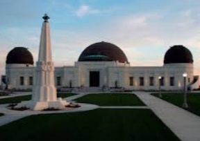
Image of Griffith Observatory:
Check out some more famous and interesting places on our planet:
- Black Rock City
- Six Flags Great Adventure
- Gulf State Park
- PIER 39
- Philadelphia Zoo
- Six Flags Discovery Kingdom
- Legoland California Resort
- Disneyland Park
- Cedar Point
- Yellowstone National Park
- Kings Island
- Georgia Aquarium
- The London Eye
- Marina Bay Sands
This satellite map of Griffith Observatory is provided by Bing Maps.
Please add a bookmark and share the page with your friends!