Please share the link with friends and neighbors:
Share on Facebook
Share on WhatsApp
Share on Telegram
Share on Facebook
Share on WhatsApp
Share on Telegram
Marina Bay Sands is listed in:
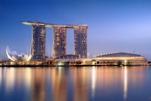
Image of Marina Bay Sands:
Check out some more famous and interesting places on our planet:
- Comcast Technology Center
- Salesforce Tower
- Wilshire Grand Center
- Trump Tower
- The Mayo Hotel
- John Hancock Center
- U.S. Bank Tower
- One57
- Comcast Center
- Aon Center
- 432 Park Avenue
- CN Tower
- Marina 101
- Allerton Hotel
- Kingdom Tower
- Willis Tower
- Taipei 101
- Burj Khalifa
- Burj al Arab
- The Shard
This satellite map of Marina Bay Sands is provided by Bing Maps.
Please add a bookmark and share the page with your friends!