The exact coordinates of Clarksville Arkansas for your GPS track:
Latitude 35.471199 North, Longitude 93.468651 West.
Please share the link with friends and neighbors:
Share on Facebook
Share on WhatsApp
Share on Telegram
Share on Facebook
Share on WhatsApp
Share on Telegram
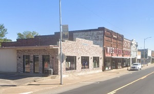
An image of Clarksville
More city maps of Arkansas:
- Map of Little Rock
Little Rock is the capital and largest city of the state of Arkansas, United States. It is located... - Map of Fayetteville
Fayetteville is a city in Washington County, Arkansas, United States. It is the third most populou... - Map of Springdale
Springdale is a city located in the northwestern part of Arkansas. Its population exceeds 81 thous... - Map of Pine Bluff
Pine Bluff, Arkansas is the county seat of Jefferson County. Pine Bluff is home to 40 thousand res... - Map of Jacksonville
Jacksonville, Arkansas is a lovely city located 15 miles northeast of Little Rock, in Pulaski Coun... - Map of Bryant
Bryant, Arkansas is a shining city situated in Saline County, about 18 miles southwest of Little R... - Map of Hot Springs Village
Hot Springs Village is a gated community located in the central region of Arkansas. It is the larg... - Map of Mountain Home
Mountain Home is a city located in the north-central region of Arkansas. It is situated in Baxter ... - Map of Arkadelphia
Arkadelphia is a city located in the southwest region of Arkansas. It is the county seat of Clark ... - Map of Monticello
Monticello is a charming city located in southeastern Arkansas. It is the county seat of Drew Coun... - Map of Pocahontas
Pocahontas is a city located in northeastern Arkansas. It serves as the county seat of Randolph Co... - Map of Ward
Ward, Arkansas is a charming city located in Lonoke County, not far from the city of Cabot and abo... - Map of Greenbrier
Greenbrier is a city located in Faulkner County, Arkansas. It stands in the central part of the st... - Map of White Hall
White Hall, Arkansas is an adorable city situated in Jefferson County. It stands in the southeaste...
Full list of Arkansas maps
This online map of Clarksville, Arkansas is provided by Bing Maps. Please add a bookmark and share the page with your friends!