The exact coordinates of Fort Oglethorpe Georgia for your GPS track:
Latitude 34.948605 North, Longitude 85.256813 West.
Please share the link with friends and neighbors:
Share on Facebook
Share on WhatsApp
Share on Telegram
Share on Facebook
Share on WhatsApp
Share on Telegram
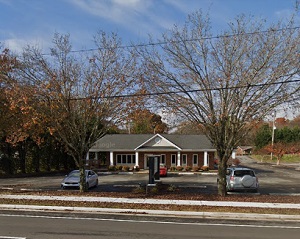
An image of Fort Oglethorpe
More city maps of Georgia:
- Map of Albany
Albany, Georgia, incorporated in 1838, is a small and beautiful city located in Dougherty County. ... - Map of Gainesville
Gainesville, Georgia is an excellent city and the county seat of Hall County. Gainesville, which s... - Map of Peachtree City
Peachtree City, Georgia is a nice city standing 30 miles southwest to Atlanta, in Fayette County. ... - Map of Tucker
Tucker, Georgia is a nice city located 14 miles northeast of Atlanta, in DeKalb County. Settled in... - Map of Redan
Redan, Georgia is a stylish CDP found in DeKalb County, about 16 miles east of Atlanta. The popula... - Map of LaGrange
The city of LaGrange, Georgia is the county seat of Troup County. Incorporated in December 1828, t... - Map of Chamblee
Chamblee is a city located in DeKalb County, Georgia, United States, northeast of Atlanta. Chamble... - Map of Sugar Hill
Sugar Hill is a city located in Gwinnett County, Georgia, United States. It is located in the nor... - Map of Acworth
Acworth is a city located in Cobb County, Georgia, United States. It is located in the northwest p... - Map of Plains
Plains, Georgia, is a tiny town situated near Americus in Sumter County. It is known as the birthp... - Map of Thomasville
Thomasville, Georgia is a city located in Thomas County, in the southern part of the state, near t... - Map of Winder
Winder, Georgia is a beautiful city located in Barrow County, in the northeastern part of the stat... - Map of Calhoun
Calhoun, Georgia is a lovely city located in Gordon County, about 70 miles northwest of Atlanta. T... - Map of Fairburn
Fairburn, Georgia is a lovely city located in Fulton County. It has a population of approximately ... - Map of Lithia Springs
Lithia Springs, Georgia is a lovely city located in Douglas County. It is a suburb of Atlanta, whi... - Map of Brunswick
The city of Brunswick is the county seat of Glynn County, situated on the southeastern coast of Ge... - Map of Lilburn
Lilburn, Georgia is a charming city found in Gwinnett County. It is located in the Atlanta metropo...
Full list of Georgia maps
This online map of Fort Oglethorpe, Georgia is provided by Bing Maps. Please add a bookmark and share the page with your friends!