The exact coordinates of Manchester Iowa for your GPS track:
Latitude 42.484978 North, Longitude 91.457909 West.
Please share the link with friends and neighbors:
Share on Facebook
Share on WhatsApp
Share on Telegram
Share on Facebook
Share on WhatsApp
Share on Telegram
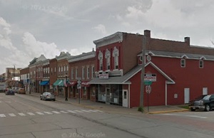
An image of Manchester
More city maps of Iowa:
- Map of Des Moines
Des Moines is the capital city of the state of Iowa, located in the central part of the state. It ... - Map of Davenport
Davenport is a large city in eastern Iowa, on a bank of Mississippi. The population of Davenport h... - Map of Bettendorf
Bettendorf, Iowa is a wonderful city situated near Davenport in Scott County. Today Bettendorf is ... - Map of Fort Dodge
Fort Dodge, Iowa, is the county seat and largest city in Webster County. Fort Dodge is located on ... - Map of Coralville
Coralville, Iowa is a city located in Johnson County, Iowa, United States. It is a suburb of Iowa ... - Map of Clive
Clive, Iowa is a shining city located in Polk County. It is a suburb of Des Moines and has a popul... - Map of Boone
Boone, Iowa is a small city located in central Iowa, and is the county seat of Boone County. Boone... - Map of Pella
Pella is a wonderful city found in central Iowa, and is the county seat of Marion County. Pella is... - Map of Keokuk
Keokuk is a pleasant city located in southeastern Iowa, and is the county seat of Lee County. Keok... - Map of Bondurant
Bondurant, Iowa is a lovely city located in Polk County. It is a rapidly growing community situate... - Map of Decorah
Decorah is a city located in Winneshiek County, in the northeastern part of Iowa, near the border ... - Map of Charles City
Charles City, Iowa is the county seat of Floyd County. The city stands in northeastern Iowa along ... - Map of Adel
Adel is a city in Dallas County, in central Iowa, about 20 miles west of the city of Des Moines. A... - Map of Asbury
Asbury is a city located in Dubuque County, in eastern Iowa, near the city of Dubuque. Asbury has ... - Map of DeWitt
DeWitt is a city located in Clinton County, eastern Iowa, about 20 miles north of the city of Dave... - Map of Winterset
Winterset, Iowa is a wonderful city located in Madison County. It is the county seat of Madison Co...
Full list of Iowa maps
This online map of Manchester, Iowa is provided by Bing Maps. Please add a bookmark and share the page with your friends!