The exact coordinates of Nevada Iowa for your GPS track:
Latitude 42.022671 North, Longitude 93.452393 West.
Please share the link with friends and neighbors:
Share on Facebook
Share on WhatsApp
Share on Telegram
Share on Facebook
Share on WhatsApp
Share on Telegram
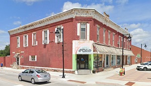
An image of Nevada
More city maps of Iowa:
- Map of Iowa City
Iowa City is the 5-th largest city in Iowa with population of almost 72 thousand people.... - Map of West Des Moines
West Des Moines is a large western suburb of Des Moines with 65 thousand residents. It is divided ... - Map of Mason City
Mason City, Iowa is the county seat of Cerro Gordo County. The population of Mason City exceeds 27... - Map of Johnston
Johnston, Iowa is a city located in Polk County, Iowa, United States. It is a suburb of Des Moines... - Map of Altoona
Altoona, Iowa is a city located in Polk County, Iowa, United States. It is a suburb of Des Moines,... - Map of Indianola
Indianola is a wonderful city in south-central Iowa, and is the county seat of Warren County. Indi... - Map of Spencer
Spencer is a pleasant city located in northwestern Iowa, and is the county seat of Clay County. Sp... - Map of Waverly
Waverly is a charming city located in northeastern Iowa, and is the county seat of Bremer County. ... - Map of Grinnell
Grinnell is a beautiful city located in Poweshiek County, central Iowa. Grinnell College, a privat... - Map of Denison
Denison is a city located in Crawford County, in western Iowa. The local economy historically has ... - Map of Knoxville
Knoxville is a wonderful city that stands in south-central Iowa and serves as the county seat of M... - Map of Independence
Independence is a shining city situated in Buchanan County, in northeastern Iowa. The local econom... - Map of Tiffin
Tiffin is a wonderful city found in Johnson County, in eastern Iowa, to the northwest of Iowa City... - Map of Spirit Lake
Spirit Lake, Iowa is a pleasant city located in Dickinson County. It stands in the northwestern pa... - Map of Clarinda
Clarinda is a city that serves as the county seat of Page County, Iowa. It stands in southwestern ... - Map of Cherokee
Cherokee, Iowa is a city that serves as the county seat of Cherokee County. The economy of Cheroke...
Full list of Iowa maps
This online map of Nevada, Iowa is provided by Bing Maps. Please add a bookmark and share the page with your friends!