The exact coordinates of Rushville Indiana for your GPS track:
Latitude 39.609444 North, Longitude 85.446243 West.
Please share the link with friends and neighbors:
Share on Facebook
Share on WhatsApp
Share on Telegram
Share on Facebook
Share on WhatsApp
Share on Telegram
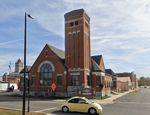
An image of Rushville
More city maps of Indiana:
- Map of Evansville
Evansville is the third largest city in Indiana. It is located on the south-western edge of the st... - Map of Hammond
Hammond is a city in north-western Indiana, adjacent to Chicago metropolitan area. The population ... - Map of Elkhart
Elkhart, Indiana is a nice city located near South Bend, in Elkhart County. The approximate popula... - Map of Lawrence
Lawrence, Indiana is a lovely city situated about 10 miles northeast to Indianapolis, in Marion Co... - Map of Richmond
Richmond, Indiana is a wonderful city situated 72 miles east of Indianapolis, in Wayne County. Tod... - Map of Zionsville
Zionsville, Indiana is a charming town located 17 miles northwest of Indianapolis, in Boone County... - Map of East Chicago
East Chicago is a city in Lake County, Indiana, United States. It is located in the Chicago metrop... - Map of La Porte
La Porte is a city in La Porte County, Indiana, United States. It is located about 50 miles west o... - Map of Highland
Highland, Indiana is a shining town located in Lake County. Incorporated on April 4, 1910, today H... - Map of Huntington
Huntington is a lovely city located in the northeastern part of Indiana, in Huntington County. The... - Map of Griffith
Griffith is a town located in the northwest corner of Indiana, in Lake County. The town has a popu... - Map of Chesterton
Chesterton is a town located in the northwest corner of Indiana, in Porter County. It is part of t... - Map of Lake Station
Lake Station, Indiana is a city located in Lake County. It has a population of around 13 thousand ... - Map of Greensburg
The city of Greensburg, Indiana is the county seat of Decatur County. It is located approximately ... - Map of Danville
Danville, Indiana is an adorable town located in Hendricks County. Danville is the county seat of ... - Map of Kendallville
Kendallville, Indiana is a beautiful city located in Wayne Township, Noble County, approximately 4... - Map of Mooresville
Mooresville, Indiana is a shining town located in Brown Township, Morgan County. It's about 20 mil...
Full list of Indiana maps
This online map of Rushville, Indiana is provided by Bing Maps. Please add a bookmark and share the page with your friends!