The exact coordinates of Iola Kansas for your GPS track:
Latitude 37.923088 North, Longitude 95.40181 West.
Please share the link with friends and neighbors:
Share on Facebook
Share on WhatsApp
Share on Telegram
Share on Facebook
Share on WhatsApp
Share on Telegram
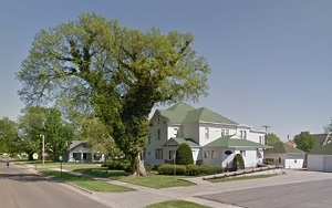
An image of Iola
More city maps of Kansas:
- Map of Shawnee
Shawnee is a city in Johnson County of Kansas, an important part of Kansas City metropolitan area ... - Map of Salina
Salina is a city in central Kansas with 47 thousand residents. It was founded in 1858 and incorpor... - Map of Hutchinson
Hutchinson, Kansas is a nice city and the county seat of Reno County. Incorporated back in 1872, ... - Map of Derby
Derby is a city located in Sedgwick County, Kansas, United States. It is a suburb of Wichita and i... - Map of Hays
Hays, Kansas is a wonderful city and the county seat of Ellis County. It is located in the central... - Map of Liberal
Liberal is a city located in Seward County, Kansas. It srands in the southwestern part of the stat... - Map of El Dorado
El Dorado is a city located in Butler County, Kansas. It stands in the south-central part of the s... - Map of Merriam
Merriam, Kansas is a charming city found in Johnson County. It stands in northeast Kansas, approxi... - Map of Spring Hill
Spring Hill is a city located in Johnson County, in northeastern Kansas, about 40 miles southwest ... - Map of Chanute
Chanute, Kansas is an adorable city located in Neosho County, in southeastern Kansas, approximate... - Map of Fort Scott
Fort Scott is a lovely city situated in Bourbon County in southeastern Kansas. Fort Scott was esta... - Map of Pratt
Pratt, Kansas is a wonderful city that serves as the county seat of Pratt County. It stands in sou... - Map of Tonganoxie
Tonganoxie, Kansas is a city located in Leavenworth County, about 30 miles southwest of Kansas Cit...
Full list of Kansas maps
This online map of Iola, Kansas is provided by Bing Maps. Please add a bookmark and share the page with your friends!