The exact coordinates of Aberdeen Maryland for your GPS track:
Latitude 39.510441 North, Longitude 76.163033 West.
Please share the link with friends and neighbors:
Share on Facebook
Share on WhatsApp
Share on Telegram
Share on Facebook
Share on WhatsApp
Share on Telegram
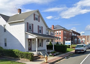
An image of Aberdeen
More city maps of Maryland:
- Map of Columbia
Columbia, Maryland is a planned comunity consisting of a dozen of villages built especially for de... - Map of Ellicott City
Ellicott City, Maryland is a CDP that serves as the county seat of Howard County. Its population e... - Map of Towson
Towson, Maryland is a northern suburb of Baltimore with 58 thousand residents. The famous Towson U... - Map of North Bethesda
North Bethesda, Maryland is a CDP located about 12 miles north to Washington DC. It belongs to Mon... - Map of Potomac
Potomac, Maryland is a beautiful CDP located in Montgomery County, on the northwestern edge of Was... - Map of Essex
Essex, Maryland is an coastal CDP situated on the eastern edge of Baltimore. Essex is populated th... - Map of College Park
College Park, Maryland is a nice suburban city of Washington, DC, located in St. George's County. ... - Map of Pikesville
Pikesville, Maryland is a lovely CDP situated on the northwestern outskirts of Baltimore. Today Pi... - Map of Parkville
Parkville, Maryland is a northern suburb of Baltimore. The population of Parkville exceeds 30 thou... - Map of Crofton
Crofton, Maryland is a planned CDP located 23 miles northeast of Washington, DC, in Anne Arundel C... - Map of Ilchester
Ilchester, Maryland is a beautiful suburban CDP of Baltimore, located in Howard County. Ilchester ... - Map of Edgewood
Edgewood, Maryland is a cool CDP asituated about 29 miles northeast of Baltimore, in Harford Count... - Map of North Potomac
North Potomac, Maryland is a CDP found 22 northwest of Washingnot DC, in Montgomery County. The po... - Map of Ballenger Creek
Ballenger Creek, Maryland is a stylish CDP located 48 miles northwest of Washington, DC, in Freder... - Map of Rosedale
Rosedale is an unincorporated community located in Baltimore County, Maryland. It stands in the no... - Map of Beltsville
Beltsville is an unincorporated community located in Prince George's County and Montgomery County,... - Map of Calverton
Calverton, Maryland is a lovely unincorporated community located in Montgomery County. It stands i...
Full list of Maryland maps
This online map of Aberdeen, Maryland is provided by Bing Maps. Please add a bookmark and share the page with your friends!