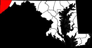
The borders of Garrett County over the map of Maryland
Explore some more counties of Maryland:
- Worcester County
- Wicomico County
- Washington County
- Talbot County
- Somerset County
- Kent County
- Howard County
- Harford County
- Frederick County
- Dorchester County
- Charles County
- Cecil County
- Carroll County
- Caroline County
- Calvert County
- Anne Arundel County
- Allegany County
- Baltimore County
- Prince George's County
- Montgomery County
Full list of Maryland maps
This online map of Garrett County, Maryland is provided by Bing Maps. Please add a bookmark and share the page with your friends!