The exact coordinates of Maryland City Maryland for your GPS track:
Latitude 39.094055 North, Longitude 76.822617 West.
Please share the link with friends and neighbors:
Share on Facebook
Share on WhatsApp
Share on Telegram
Share on Facebook
Share on WhatsApp
Share on Telegram
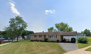
An image of Maryland City
More city maps of Maryland:
- Map of Baltimore
Baltimore is the biggest city of Maryland. It is a historic and vibrant city located on the east c... - Map of Rockville
Rockville, Maryland is located in Montgomery County... - Map of Silver Spring
Silver Spring, Maryland is a large CDP in Montgomery Co... - Map of Dundalk
Dundalk, Maryland is a large eastern suburb of Baltimore with 63 thousand residents. This CGP is n... - Map of Bel Air South
Bel Air South, Maryland is a CDP with 55 thousand residents, located about 25 miles northeast to B... - Map of Catonsville
Catonsville, Maryland is a suburban CDP of Baltimore situated in Baltimore County. Catonsville is ... - Map of Randallstown
Randallstown, Maryland is a suburban CDP of Baltimore. Randallstown is populated these days by 36 ... - Map of Chillum
Chillum, Maryland is a suburban CDP of Washington, DC, situated in Prince George's County. The app... - Map of Carney
Carney, Maryland is a stylish CDP found 12 miles northeast of Baltimore. The population of Carney ... - Map of Perry Hall
Perry Hall, Maryland is a CDP located 16 miles northeast of Baltimore. Perry Hall is home to 28 th... - Map of Lochearn
Lochearn, Maryland is a suburban CDP of Baltimore. Today Lochearn is home to 26 thousand residents... - Map of Fort Washington
Fort Washington, Maryland is a wonderful CDP situated on the southern outskirts of Washington, DC,... - Map of Camp Springs
Camp Springs, Maryland is a pleasant CDP found 13 miles southeast of Washington DC, in Prince Geor... - Map of Lake Shore
Lake Shore, Maryland is a charming community located in Anne Arundel County. It stands on the west... - Map of East Riverdale
East Riverdale is an unincorporated community located in Prince George's County, Maryland. It stan... - Map of Easton
Easton, Maryland is a lovely city located in Talbot County. It stands on Maryland's Eastern Shore,... - Map of Elkton
Elkton is a town located in Cecil County, Maryland. It stands in the northeastern part of the stat...
Full list of Maryland maps
This online map of Maryland City, Maryland is provided by Bing Maps. Please add a bookmark and share the page with your friends!