The exact coordinates of Spring Lake Michigan for your GPS track:
Latitude 43.076717 North, Longitude 86.185112 West.
Please share the link with friends and neighbors:
Share on Facebook
Share on WhatsApp
Share on Telegram
Share on Facebook
Share on WhatsApp
Share on Telegram
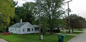
An image of Spring Lake
More city maps of Michigan:
- Map of Detroit
Detroit is the biggest city in Michigan. It's a big industrial center known for its vehicle indust... - Map of Livonia
Livonia, Michigan is a city in Wayne County with 94 thousand residents. It is located about 20 mil... - Map of Farmington Hills
Farmington Hills, Michigan is a northern suburb of Detroit with 83 thousand residents. The city wa... - Map of Taylor
Taylor, Michigan is a cool city located in Wayne County, on the southern edge of Detroit metro are... - Map of Ypsilanti
Ypsilanti, Michigan is a beautiful city situated in Washtenw County. Ypsilanti is home to 20 thous... - Map of Roseville
Roseville, Michigan is a nice suburb of Detroit situated in Macomb County. Roseville is home to 47... - Map of Bloomfield Township
Bloomfield, Michigan is a charter township located about 25 miles northwest to Detroit, in Oakland... - Map of Grand Blanc
Grand Blanc, Michigan is a nice township located near Flint, in Genesee County. Founded in 1833, t... - Map of Muskegon
Muskegon, Michigan is a lakeside city and the county seat of Muskegon County. Today Muskegon is po... - Map of Brownstown
Brownstown, Michigan is a charter township situated about 22 miles southwest of Detroit, in Wayne ... - Map of Jackson
Jackson, Michigan is a stylish city and county seat of Jackson County. The population of Jackson e... - Map of Southgate
Southgate, Michigan is a beautiful city located in Wayne County, 14 miles southwest of downtown De... - Map of Madison Heights
Madison Heights, Michigan is a beautiful city located 12 miles north of downtown Detroit, in Oakla... - Map of Byron Township
Byron Township, Michigan is found in Kent County, about 13 miles south of Grand Rapids. The popula... - Map of Walker
Walker, Michigan is a beautiful city located in Kent County, to the northwest of Grand Rapids. Wal... - Map of Harrison Township
Harrison Township, Michigan is a stylish city found in Macomb County. The population of Harrison T... - Map of Birmingham
Birmingham, Michigan is a wonderful city situated in Oakland Countyб 20 miles northwest of Detroi...
Full list of Michigan maps
This online map of Spring Lake, Michigan is provided by Bing Maps. Please add a bookmark and share the page with your friends!