The exact coordinates of Town and Country Missouri for your GPS track:
Latitude 38.615856 North, Longitude 90.464333 West.
Please share the link with friends and neighbors:
Share on Facebook
Share on WhatsApp
Share on Telegram
Share on Facebook
Share on WhatsApp
Share on Telegram
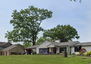
An image of Town and Country
More city maps of Missouri:
- Map of Florissant
Florissant, Missouri is a nice suburban city of St. Louis. The population of Florissant exceeds 52... - Map of Oakville
Oakville, Missouri is a CDP found in St. Louis County. The population of Oakville exceeds 36 thous... - Map of Gladstone
Gladstone, Missouri is a city located in Clay County, about 10 miles north of downtown Kansas City... - Map of Nixa
Nixa, Missouri is a city in Christian County, located just south of Springfield. Nixa is known for... - Map of Rolla
Rolla, Missouri is an adorable city located in Phelps County, about 95 miles southwest of St. Loui... - Map of Warrensburg
Warrensburg is a city located in Johnson County, Missouri. It stands in the western part of the st... - Map of Manchester
Manchester, Missouri is an adorable city located in St. Louis County. It stands in the western par... - Map of Clayton
Clayton, Missouri is a lovely city situated in the central part of St. Louis County, just west of ... - Map of Overland
Overland, Missouri is a shining city located in St. Louis County. It stands in the central part of... - Map of Washington
Washington, Missouri is a city located in Franklin County. It stands in the eastern part of the st... - Map of Webb City
Webb City, Missouri is an adorable city located in Jasper County. It stands in the southwestern pa... - Map of Crestwood
Crestwood, Missouri is a wonderful city situated in St. Louis County. It stands in the eastern par... - Map of Excelsior Springs
Excelsior Springs, Missouri is a charming city located in Clay and Ray counties, about 30 miles no...
Full list of Missouri maps
This online map of Town and Country, Missouri is provided by Bing Maps. Please add a bookmark and share the page with your friends!