The exact coordinates of Lexington Nebraska for your GPS track:
Latitude 40.780132 North, Longitude 99.741508 West.
Please share the link with friends and neighbors:
Share on Facebook
Share on WhatsApp
Share on Telegram
Share on Facebook
Share on WhatsApp
Share on Telegram
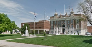
An image of Lexington
More city maps of Nebraska:
- Map of Lincoln
Lincoln is the capital and second-most populous city of the state of Nebraska, located in the east... - Map of Columbus
Columbus, Nebraska is a lovely city and the county seat of Platte County. Settled in 1856, today C... - Map of La Vista
La Vista, Nebraska is a shining city located in Sarpy County. It stands in the eastern part of the...
Full list of Nebraska maps
This online map of Lexington, Nebraska is provided by Bing Maps. Please add a bookmark and share the page with your friends!