The exact coordinates of Milford New Hampshire for your GPS track:
Latitude 42.835518 North, Longitude 71.648338 West.
Please share the link with friends and neighbors:
Share on Facebook
Share on WhatsApp
Share on Telegram
Share on Facebook
Share on WhatsApp
Share on Telegram
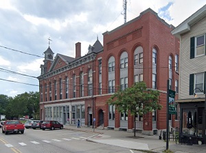
An image of Milford
More city maps of New Hampshire:
- Map of Derry
Derry, New Hampshire is a nice town located in Rockingham County, about 41 miles north of Boston. ... - Map of Bedford
Bedford, New Hampshire is a lovely town located in Hillsborough County. Incorporated in 1750, Bedf... - Map of Lebanon
Lebanon is a shining city located in Grafton County, in the western part of New Hampshire. Situate... - Map of Hanover
Hanover is a town located in Grafton County, in western New Hampshire. It stands along the Connect...
Full list of New Hampshire maps
This online map of Milford, New Hampshire is provided by Bing Maps. Please add a bookmark and share the page with your friends!