Boulder City, Nevada is a lovely city located in Clark County. It stands approximately 26 miles southeast of Las Vegas and is known for its unique history and scenic location near the Hoover Dam. Boulder City was established in 1931 as a housing community for workers involved in the construction of the Hoover Dam, a massive engineering project that created Lake Mead, the largest reservoir in the United States. Today Boulder City is home to 15 thousand residents. This online map shows the exact scheme of Boulder City streets, including major landmarks and natural objecsts.
Zoom in or out using the plus/minus buttons on the map. Move the center of this map by dragging it.
You are also welcome to check out the satellite map,
Google map, things to do, open street map and street view
of Boulder City.
The exact coordinates of Boulder City Nevada for your GPS track:
Latitude 35.973846 North, Longitude 114.841751 West.
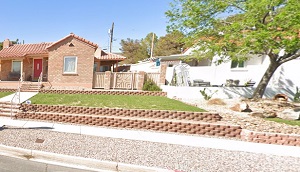
An image of Boulder City

More city maps of Nevada:
- Map of Sparks
Sparks, Nevada (incorporated 1905) is a city located east to Reno, in Washoe County. The populatio... - Map of Sun Valley
Sun Valley, Nevada is a wonderful CDP situated in Washoe County. Today Sun Valley is populated by ...
This online map of Boulder City, Nevada is provided by Bing Maps.
Please add a bookmark and share the page with your friends!

