The exact coordinates of Baker City Oregon for your GPS track:
Latitude 44.775227 North, Longitude 117.834435 West.
Please share the link with friends and neighbors:
Share on Facebook
Share on WhatsApp
Share on Telegram
Share on Facebook
Share on WhatsApp
Share on Telegram
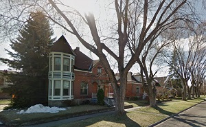
An image of Baker City
More city maps of Oregon:
- Map of Portland
Portland, Oregon is the largest city in the state and the county seat of Multnomah County with tot... - Map of Hillsboro
Hillsboro is the county seat of Washington County and a large western satellite of Portland, Orego... - Map of Springfield
Springfield, Oregon (incorporated in 1885) is a suburb of Eugene located in Lane County. The popul... - Map of Albany
Albany, Oregon is a lovely city and the county seat of Linn County. The city stands about 70 miles... - Map of Keizer
Keizer, Oregon is a handsome city locatednear Salem, in Marion County. Incorporated in 1982, Keiz... - Map of Tualatin
Tualatin, Oregon is a dynamic city situated in Washington County. Today Tualatin is populated by 2... - Map of Forest Grove
Forest Grove, Oregon is a wonderful city situated about 26 miles west of Portland, in Washington C... - Map of Hayesville
Hayesville, Oregon is a pleasant CDP located in Marion County. The population of Hayesville exceed... - Map of Cedar Mill
Cedar Mill, Oregon is an unincorporated community located in Washington County, approximately 10 m... - Map of Pendleton
Pendleton, Oregon is a pleasant city found in Umatilla County. It sits in the northeastern part of... - Map of Coos Bay
Coos Bay, Oregon is a charming city located in Coos County, approximately 200 miles southwest of P... - Map of Sandy
Sandy, Oregon is a charming city found in Clackamas County. It stands in the northwestern part of ... - Map of Damascus
Damascus is a census-designated place in Clackamas County, Oregon. It is known for its rural and s... - Map of Newport
Newport, Oregon is an adorable city located in Lincoln County. It sits along the central Oregon co...
Full list of Oregon maps
This online map of Baker City, Oregon is provided by Bing Maps. Please add a bookmark and share the page with your friends!