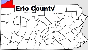
The borders of Erie County over the map of Pennsylvania
Explore some more counties of Pennsylvania:
- York County
- Wyoming County
- Westmoreland County
- Wayne County
- Washington County
- Warren County
- Venango County
- Union County
- Tioga County
- Susquehanna County
- Sullivan County
- Somerset County
- Snyder County
- Schuylkill County
- Potter County
- Pike County
- Perry County
- Northumberland County
- Northampton County
- Montour County
Full list of Pennsylvania maps
This online map of Erie County, Pennsylvania is provided by Bing Maps. Please add a bookmark and share the page with your friends!