The exact coordinates of Harborcreek Pennsylvania for your GPS track:
Latitude 42.166142 North, Longitude 79.95327 West.
Please share the link with friends and neighbors:
Share on Facebook
Share on WhatsApp
Share on Telegram
Share on Facebook
Share on WhatsApp
Share on Telegram
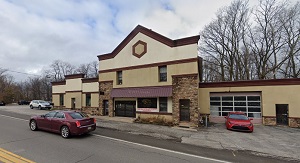
An image of Harborcreek
More city maps of Pennsylvania:
- Map of Scranton
Scranton is a city in northern Pennsylvania, in the so called Wyoming Valley. The population of Sc... - Map of Altoona
Altoona, incorporated 1868, is a city in central Pennsylvania. It is located in Blair County, 200 ... - Map of Upper Darby
Upper Darby Township is a large western suburb of Philadelphia with 82 thousand residents. It is l... - Map of Millcreek
Millcreek, Pennsylvania is a beautiful suburban township of Erie located in Erie County. Millcreek... - Map of York
York, Pennsylvania is a beautiful city located about 94 miles west to Philadelphia. It is the coun... - Map of Penn Hills
Penn Hills, Pennsylvania is a lovely township situated about 13 miles northeast to Pittsburgh, in ... - Map of Cranberry Township
Cranberry, Pennsylvania is a beautiful township located about 20 miles north to Pittsburgh, in But... - Map of Warminster
Warminster, Pennsylvania is a nice township located in Bucks County. The approximate population of... - Map of Tredyffrin
Tredyffrin, Pennsylvania is a suburban township of Philadelphia, situated in Chester County. Tredy... - Map of Whitehall Township
Whitehall Township, Pennsylvania is located near Allentown in Lehigh County. Established in 1753, ... - Map of Shaler
Shaler, Pennsylvania is a suburban township located north of Pittsburgh, in Allegheny County. Shal... - Map of Plum
Plum, Pennsylvania is a suburban borough of Pittsburgh situated in Allegheny County. Today Plum is... - Map of East Hempfield
East Hempfield, Pennsylvania is a nice township located 75 miles west of Philadelphia, in Lancaste... - Map of Lower Providence
Lower Providence, Pennsylvania is a township located in Montgomery County. Established in 1805, Lo... - Map of Marple
Marple, Pennsylvania is a township located in Delaware County. Settled in 1684, Marple Township is... - Map of Dover
Dover Township, Pennsylvania is located in York County. Incorporated back in 1747, Dover Township ... - Map of New Castle
New Castle, Pennsylvania is a shining city and the county seat of Lawrence County. Founded in 1798...
Full list of Pennsylvania maps
This online map of Harborcreek, Pennsylvania is provided by Bing Maps. Please add a bookmark and share the page with your friends!