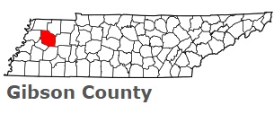
The borders of Gibson County over the map of Tennessee
Explore some more counties of Tennessee:
- Wilson County
- Williamson County
- White County
- Weakley County
- Wayne County
- Washington County
- Warren County
- Van Buren County
- Union County
- Unicoi County
- Trousdale County
- Tipton County
- Sumner County
- Sullivan County
- Stewart County
- Smith County
- Sevier County
- Sequatchie County
- Scott County
- Rutherford County
Full list of Tennessee maps
This online map of Gibson County, Tennessee is provided by Bing Maps. Please add a bookmark and share the page with your friends!