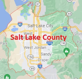
The borders of Salt Lake County over the map of Utah
Explore some more counties of Utah:
- Weber County
- Wayne County
- Washington County
- Wasatch County
- Utah County
- Uintah County
- Tooele County
- Summit County
- Sevier County
- Sanpete County
- San Juan County
- Rich County
- Piute County
- Morgan County
- Millard County
- Kane County
- Juab County
- Iron County
- Grand County
- Garfield County
Full list of Utah maps
This online map of Salt Lake County, Utah is provided by Bing Maps. Please add a bookmark and share the page with your friends!