The exact coordinates of Tooele Utah for your GPS track:
Latitude 40.530643 North, Longitude 112.298492 West.
Please share the link with friends and neighbors:
Share on Facebook
Share on WhatsApp
Share on Telegram
Share on Facebook
Share on WhatsApp
Share on Telegram
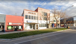
An image of Tooele
More city maps of Utah:
- Map of Orem
Orem is a city in Utah, north to Provo, with 88 thousand inhabitants.... - Map of Layton
Layton is a city in northern Utah. It is a part of Ogden–Clearfield metro area. The population o... - Map of Lehi
Lehi, Utah (incorporated in 1852) is a southern suburb of Salt Lake City and a part of Provo–Ore... - Map of Murray
Murray, Utah is a southern suburb of Salt Lake City with 49 thousand residents. The city was incor... - Map of Herriman
Herriman, Utah is a nice city located about 27 miles south of Salt Lake City. Founded in 1851 and ... - Map of Saratoga Springs
Saratoga Springs, Utah is a beautiful city situated on the coasts of Utah Lake. Today Saratoga Spr... - Map of Cottonwood Heights
Cottonwood Heights, Utah is a suburban city of Salt Lake City, located in Lake County. Incorporate... - Map of Farmington
Farmington, Utah is a wonderful city located in the northern part of Davis County, with the Wasatc... - Map of North Ogden
North Ogden, Utah is a lovely city located in the northern part of Weber County, in the Wasatch Mo... - Map of Brigham City
Brigham City is located in Box Elder County, Utah. It stands in the northern part of the state and... - Map of Bluffdale
Bluffdale, Utah is a city in Salt Lake County. It stands in the southwestern part of the county an... - Map of Vineyard
Vineyard, Utah is a wonderful town found in Utah County. It stands in the central part of the stat... - Map of Pleasant View
Pleasant View is a city in Weber County, Utah. It stands in the northern part of the state and is ...
Full list of Utah maps
This online map of Tooele, Utah is provided by Bing Maps. Please add a bookmark and share the page with your friends!