The exact coordinates of Lake Monticello Virginia for your GPS track:
Latitude 37.932453 North, Longitude 78.332947 West.
Share on Facebook
Share on WhatsApp
Share on Telegram
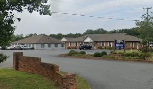
An image of Lake Monticello

More city maps of Virginia:
- Map of Chesapeake
Chesapeake is the third most populous city in Virginia with some 251 thousand inhabitants. It is l... - Map of Charlottesville
Charlottesville is a city in central Virginia with 47 thousand inhabitants. This city became famou... - Map of Portsmouth
Portsmouth, Virginia is a coastal city with almost 100 thousand residents. It was founded in 1752 ... - Map of Dale City
Dale City, Virginia is a CDP with 72 thousand inhabitants located in Prince William County, about ... - Map of Blacksburg
Blacksburg, Virginia is a town with 44 thousand residents, standing in Montgomery County, about 26... - Map of Oakton
Oakton, Virginia is an attractive CDP located 18 miles west to Washington, DC, in Fairfax County. ... - Map of Springfield
Springfield, Virginia is a CDP in Fairfax County, about 15 miles southwest of Washington, DC. The ... - Map of Staunton
Staunton, Virginia is an independent city located inside Augusta County. Incorporated in 1801, tod... - Map of Chantilly
Chantilly, Virginia is a lovely CDP located in Fairfax County. Today Chantilly is home to 24 thous... - Map of Lincolnia
Lincolnia, Virginia is a charming suburban CDP found near Arlington, in Fairfax County. The popul... - Map of Montclair
Montclair, Virginia is a dynamic CDP found in Prince William County, about 30 miles southwest of W... - Map of Rose Hill
Rose Hill, Virginia is a CDP located in Fairfax County, about 15 miles southwest of Washington DC.... - Map of Meadowbrook
Meadowbrook, Virginia is a CDP located in Chesterfield County, about 10 miles south of Richmond. I... - Map of Sudley
Sudley is an unincorporated community and a CDP located in Prince William County, Virginia. It res... - Map of Burke Centre
Burke Centre is a planned community located in Fairfax County, Virginia. It stands approximately 2... - Map of Manassas Park
Manassas Park is a charming independent city located in Northern Virginia, within the Washington, ... - Map of Fort Hunt
Fort Hunt is a suburban neighborhood located in Fairfax County, Virginia, in the northern part of ...
Full list of Virginia maps
This online map of Lake Monticello, Virginia is provided by Bing Maps. Please add a bookmark and share the page with your friends!
