Please share the link with friends and neighbors:
Share on Facebook
Share on WhatsApp
Share on Telegram
Share on Facebook
Share on WhatsApp
Share on Telegram
Marrakesh is listed in:
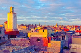
Image of Marrakesh:
Check out some more famous and interesting places on our planet:
- Khost
- Kherson
- Melitopol
- Lviv
- Zhangjiakou
- Kandahar
- Ephesus
- Acropolis of Athens
- Lascaux Cave
- Wuhan
- Teheran
- The Kremlin
- Afrin
- Kirkuk
- Raqqa
- Mosul
- Aleppo
- Rethimno
- Fallujah
- Kotor
This satellite map of Marrakesh is provided by Bing Maps.
Please add a bookmark and share the page with your friends!