Haldimand County is a rural municipality located in the province of Ontario, Canada. It is situated on the north shore of Lake Erie, between Hamilton and Niagara Falls. Haldimand County was formed in 2001 through the amalgamation of several smaller communities, including the former Haldimand County, Dunnville, and part of the former City of Nanticoke. The population of Haldimand County exceeds 45 thousand people. This map shows the detailed scheme of Haldimand County streets, including major sites and natural objecsts.
Zoom in or out, move the map's center by dragging your mouse or click the plus/minus buttons to zoom. Also check out a street view and a satellite map of Haldimand County.
The exact coordinates of Haldimand County, Canada for your GPS track:
Latitude 42.949554 North, Longitude 79.858665 West.
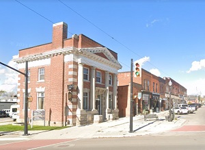
An image of Haldimand County, Canada:
Check out some more city maps in Canada:
Full list of Canada maps
This online map of Haldimand County (Canada) is provided by Bing Maps.
Please add a bookmark and share the page with your friends!