Terrebonne is a city located in the province of Quebec, Canada. It is part of the regional county municipality of Les Moulins and is situated on the north shore of the Rivière des Mille Îles, a tributary of the Saint Lawrence River. Terrebonne is known for its rich history, cultural heritage, and natural beauty. The population of Terrebonne exceeds 95 thousand people. This map shows the detailed scheme of Terrebonne streets, including major sites and natural objecsts.
Zoom in or out, move the map's center by dragging your mouse or click the plus/minus buttons to zoom.
Also check out the population, street view and a satellite map of Terrebonne.
The exact coordinates of Terrebonne, Canada for your GPS track:
Latitude 45.693127 North, Longitude 73.632233 West.
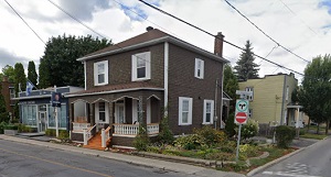
An image of Terrebonne, Canada:
Check out some more city maps in Canada:
Full list of Canada maps
This online map of Terrebonne (Canada) is provided by Bing Maps.
Please add a bookmark and share the page with your friends!