The exact coordinates of Sterling Alaska for your GPS track:
Latitude 60.536968 North, Longitude 150.778717 West.
Please share the link with friends and neighbors:
Share on Facebook
Share on WhatsApp
Share on Telegram
Share on Facebook
Share on WhatsApp
Share on Telegram
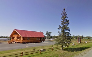
An image of Sterling
More city maps of Alaska:
- Map of Fairbanks
Fairbanks is the second largest city in Alaska after Anchorage. Its population is about 32,000 peo... - Map of North Lakes
North Lakes, Alaska is a lovely CDP located in Matanuska-Susitna Borough. Part of the former Lakes... - Map of Ketchikan
Ketchikan, Alaska is a lovely city located in Ketchikan Gateway Borough. It's known for its stunni...
Full list of Alaska maps
This online map of Sterling, Alaska is provided by Bing Maps. Please add a bookmark and share the page with your friends!