The exact coordinates of Birmingham Alabama for your GPS track:
Latitude 33.518097 North, Longitude 86.808151 West.
Please share the link with friends and neighbors:
Share on Facebook
Share on WhatsApp
Share on Telegram
Share on Facebook
Share on WhatsApp
Share on Telegram
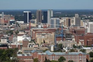
An image of Birmingham
More city maps of Alabama:
- Map of Montgomery
Montgomery is the Capital city of Alabama with population of over 200 thousand people. Today, Mont... - Map of Mobile
Mobile is the county seat of Mobile County, Alabama, United States. The city is located on the cen... - Map of Hoover
Hoover, Alabama is a southern suburb of Birmingham. The population of Hoover is over 85 thousand p... - Map of Auburn
Auburn, Alabama, is a city in the eastern part of the state with 63 thousand inhabitants. Auburn, ... - Map of Florence
Florence, incorporated in 1826, is a city Alabama and a county seat for Lauderdale County. The cit... - Map of Prattville
Prattville, Alabama is a nice city located 12 miles northwest to Montgomery. Founded back in 1839,... - Map of Trussville
Trussville, Alabama is a lovely city located about 15 miles northeast of Birmingham. Incorporated ... - Map of Albertville
Albertville, Alabama is a wonderful city situated in Marshall County. Incorporated on February 18,... - Map of Anniston
Anniston, Alabama is a pleasant city and the county seat of Calhoun County. The population of Anni... - Map of Tillmans Corner
Tillmans Corner is an unincorporated community located in Mobile County, Alabama. It is situated i... - Map of Center Point
Center Point is a city located in Jefferson County, Alabama. It stands about 12 miles northeast of... - Map of Talladega
Talladega, Alabama is a charming city located in Talladega County. It stands in the central part o... - Map of Gulf Shores
Gulf Shores, Alabama is a wonderful coastal city situated in Baldwin County, along the Gulf of Mex... - Map of McCalla
McCalla is an unincorporated community located in Jefferson County, Alabama. It is situated in the... - Map of Sylacauga
Sylacauga, Alabama is a charming city located in Talladega County, in the eastern part of the stat... - Map of Clay
Clay, Alabama is a small city located in Jefferson County. It stands in the central part of the st... - Map of Southside
Southside is a city located in Etowah County, in the northeastern part of Alabama. It is a growing...
Distances from Birmingham, Alabama:
- Distance between Birmingham and Montgomery
- Distance between Birmingham and Mobile
- Distance between Birmingham and Hoover
- Distance between Birmingham and Auburn
- Distance between Birmingham and Florence
- Distance between Birmingham and Prattville
- Distance between Birmingham and Trussville
- Distance between Birmingham and Albertville
- Distance between Birmingham and Anniston
- Distance between Birmingham and Tillmans Corner
- Distance between Birmingham and Center Point
- Distance between Birmingham and Talladega
- Distance between Birmingham and Gulf Shores
- Distance between Birmingham and McCalla
- Distance between Birmingham and Sylacauga
- Distance between Birmingham and Clay
- Distance between Birmingham and Southside
Full list of Alabama maps
This online map of Birmingham, Alabama is provided by Bing Maps. Please add a bookmark and share the page with your friends!