The exact coordinates of Vestavia Hills Alabama for your GPS track:
Latitude 33.446873 North, Longitude 86.788223 West.
Please share the link with friends and neighbors:
Share on Facebook
Share on WhatsApp
Share on Telegram
Share on Facebook
Share on WhatsApp
Share on Telegram
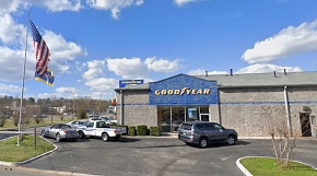
An image of Vestavia Hills
More city maps of Alabama:
- Map of Decatur
Decatur (incorporated 1826) is a city in the northern part of Alabama with 55 thousand inhabitants... - Map of Alabaster
Alabaster is a wonderful suburban city situated in Shelby County of central Alabama. Today Alabast... - Map of Enterprise
Enterprise, Alabama is a shining city located in Coffee and Dale Counties. Founded in 1896, Enterp... - Map of Bessemer
Bessemer, Alabama is a hilarious city and a suburb of Birmingham, situated in Jefferson County. Fo... - Map of Mountain Brook
Mountain Brook, Alabama is a charming city and an eastern suburb of Birmingham. The population of ... - Map of Troy
Troy, Alabama is a charming city found in Pike County. It is situated in the southeastern part of ... - Map of Muscle Shoals
Muscle Shoals, Alabama is a dynamic city in Colbert County. It is situated in the northwest corner... - Map of Hartselle
Hartselle is a city in Morgan County, Alabama. It is situated about 25 miles south of Huntsville a... - Map of Ozark
Ozark, Alabama is a charming city located in Dale County, about 85 miles southeast of Montgomery. ... - Map of Jacksonville
Jacksonville, Alabama is a city located in Calhoun County, in the northeastern part of the state, ... - Map of Russellville
Russellville, Alabama is an adorable city located in Franklin County, in the northwestern part of ... - Map of Rainbow City
Rainbow City, Alabama is a lovely city found in Etowah County, in the northeastern part of the st... - Map of Pike Road
Pike Road, Alabama is a beautiful town located in Montgomery County. It is known for its community... - Map of Pleasant Grove
Pleasant Grove, Alabama is a lovely city located in western Jefferson County. It's a suburb of Bir... - Map of Guntersville
Guntersville is a wonderful city located in the northern part of Alabama. It is the county seat of... - Map of Meridianville
Meridianville, Alabama is a census-designated place located in Madison County. It stands in the no... - Map of Wetumpka
Wetumpka, Alabama is a charming city found in Elmore County. It stands along the Coosa River and i...
Distances from Vestavia Hills, Alabama:
- Distance between Vestavia Hills and Decatur
- Distance between Vestavia Hills and Alabaster
- Distance between Vestavia Hills and Enterprise
- Distance between Vestavia Hills and Bessemer
- Distance between Vestavia Hills and Mountain Brook
- Distance between Vestavia Hills and Troy
- Distance between Vestavia Hills and Muscle Shoals
- Distance between Vestavia Hills and Hartselle
- Distance between Vestavia Hills and Ozark
- Distance between Vestavia Hills and Jacksonville
- Distance between Vestavia Hills and Russellville
- Distance between Vestavia Hills and Rainbow City
- Distance between Vestavia Hills and Pike Road
- Distance between Vestavia Hills and Pleasant Grove
- Distance between Vestavia Hills and Guntersville
- Distance between Vestavia Hills and Meridianville
- Distance between Vestavia Hills and Wetumpka
Full list of Alabama maps
This online map of Vestavia Hills, Alabama is provided by Bing Maps. Please add a bookmark and share the page with your friends!